Rural Data Portal
Information, statistics, and knowledge for rural Canada.
Explore, visualize, and download data on rural health, accessibility, and social determinants. Built around the Canadian Accessibility and Remoteness Index (CARI+) and partner datasets, with plain-language summaries for datasets and research.
Featured indicator
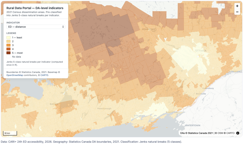
CARI+ – 24-hour Emergency Departments
Population-weighted travel time and distance to 24hr emergency departments from 2021 Dissemination Areas.
Four ways to use the portal
Read research summaries, explore indicators, view them on the map, and download the underlying data.
01 — Research
Read the research
Summaries of CARI+ research with links to preprints, peer-reviewed papers, and methods documentation.
02 — Data
Explore the data
Interactive views of CARI+ indicators, other rurality measures, and social marginalization metrics.
03 — Mapping
View on the map
Spatial views of CARI+ scores, rurality measures, and indicators of social marginalization across Canada.
04 — Download
Download the data
Versioned releases on Open Science Foundation, with R code to read everything in. Citations and licences included.
About the program
Open data and research on rural Canada
This portal supports an ongoing research program focused on rural health and the social determinants of health in Canada. The team develops open data resources and conducts analysis on service accessibility, population health indicators, and rural community wellbeing.
Everything published here is intended for researchers, policymakers, public health professionals, and community partners, and is paired with a plain-language summary so the work is useful beyond the academy.
How to cite
Suggested citations
McGaughey T, Peters PA. Canadian Accessibility and Remoteness Index (CARI+) [dataset]. Ottawa, ON: Spatial Determinants of Health Lab, Carleton University. 2026. doi:10.17605/OSF.IO/K7T32.

McGaughey T, Peters PA. Introducing the Canadian Accessibility and Remoteness Index (CARI+). Canadian Geographies / Géographies canadiennes, 70, e70082. https://doi.org/10.1111/cag.70082
See our page on Open Science Foundation more information on licensing and the use of the CARI+ for your own research.
Latest Outputs
Recent reports, research and data on rural Canada.
-
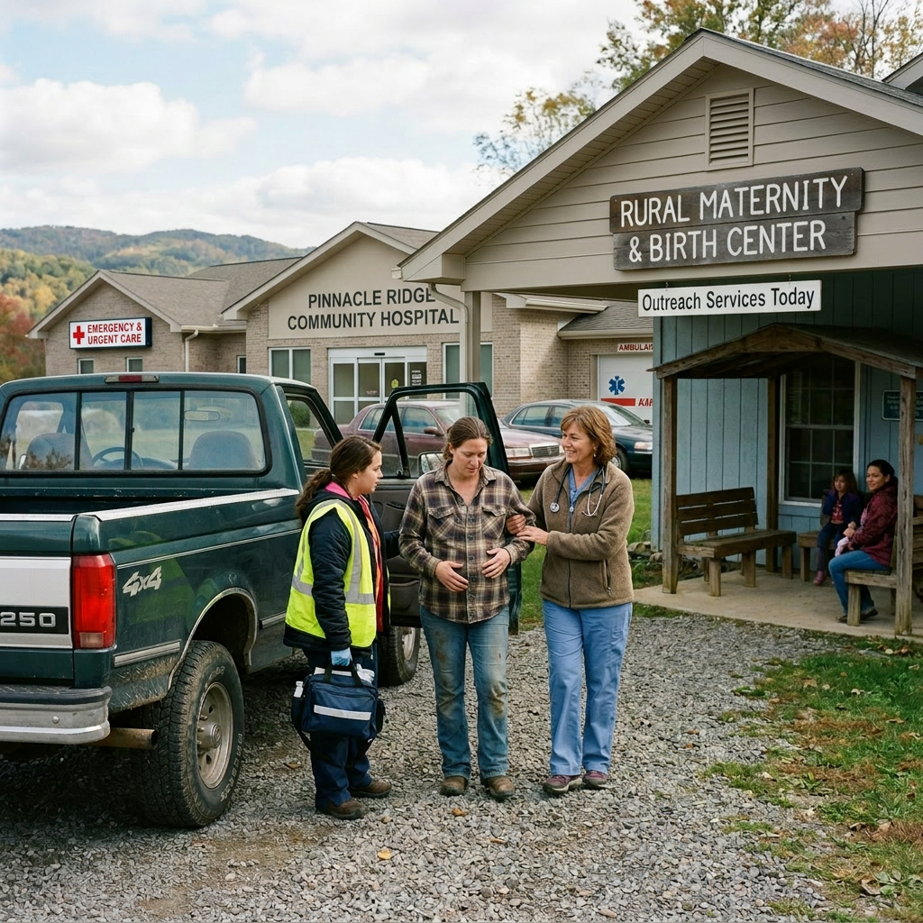
CARI+ Dataset – Birth Services
This version of the Canadian Accessibility and Remoteness Index (CARI+) measures access to public high schools in Canada via travel time and distance. Rural…
-
Mapping Access to Birth Services in Canada
This research uses the Canadian Accessibility and Remoteness Index (CARI+) to describe access to obstetrical and birth services across Canada via travel time and…
-
CARI+ Dataset – Population Centres
This generalized version of the Canadian Accessibility and Remoteness Index (CARI+) measures rurality using a population-weighted score to population centres by travel time and…
Featured research
Methods
Constructing CARI+: a population-weighted index of accessibility for rural Canada
Our core methodology paper published in Canadian Geographies / Géographies candiennes: Introducing the Canadian Accessibility and Remoteness Index (CARI+).
Application
24-hour Emergency Department access across rural Canada
Distance and travel-time accessibility to 24-hour emergency departments, derived from the Open Database of Healthcare Facilities and the Canadian Road Network File.
Plain language
What is the CARI+, in plain language?
A short explainer on the CARI+ and Rural Data project, with definitions for the calculation and measurement of rural accessibility.